Cycling Lithgow to Mittagong via the caves

Inspired by this post, and in search of something fun to do with his visiting cousin Henry, Ollie organised for the three of us to ride from Lithgow to Mittagong. We’d pass Jenolan and Wombeyan caves. The guy who’d written that blog had done it in 11 hours – surely we’d be able to make it in 2 days!

We set off from Lithgow at 9.30am, filled with pastries and hope. After a short bit of highway riding, we turned off and then were on our first hill out of Lake Lyell. Excitement! Dirt! But hard packed, and if you were paying attention you could mostly avoid the corrugations.

The 5km or so between where we met Jenolan Caves Rd, and where Duckmaloi Rd turns off for Oberon, had the most car/truck traffic we saw for the rest of the trip. Once clear of that we had a beautiful run along past Jenolan State Forest (with a brief stop to forage mushrooms).

Then down, down, down into the valley… We relaxed and enjoyed the stunning descent to Jenolan Caves. We ate lunch, watched a platypus swimming in the Blue Lake, took ourselves through the Nettle Cave.

Then reluctantly, we started up the hill back out. Bloody hell it was steep. 4.3km, 11.2% average gradient. I was in my easiest gear from the very start, and even then had to zig-zag towards the top. Ollie caught me up after stopping to take photos, and we had a race in the last 50m, though gentlemen’s discretion prevents me from revealing who won (it was me).

(Above, Ollie models the excellent Vivente World Randonneur touring bicycle. You too could own one of these bikes!)

We rode through pine plantation country, camping somewhere in Gurnang State Forest. Ollie prepared what seemed a giant pot of curry and mushrooms, though we still needed to eat some nuts, chocolate, bread, extra wraps from lunch, and a few other snacks before we felt satisfied. Some amateur stargazing followed, and we were in bed by 7.30pm.

The next day we hopped back into the saddle and set off down some more beautiful country roads, although it would have been nice if there was slightly less pine forest (which my ecologist friend calls the equivalent of a carpark). Eventually we reached the Blue Mountains National Park, and followed the Oberon-Colong Stock Route for a while.

At some point we turned off down the Mt Werong fire trail instead of the Mt Fatigue fire trail. I’m not sure what the condition of the Mt Fatigue fire trail is, but the Mt Werong trail was: Rocky. Sandy. Loose. Steep.

This next photo shows a massive downhill – Henry has just hit the last berm, with Ollie following behind. It was so steep that I was just barely slowing down without locking up my wheels on the loose surface.

There were also some uphills.

And some creek crossings.

And then some uphills that we walked/rode up, depending on how steep/loose/rocky that section was.

Eventually we reached the tarmac on the descent into Wombeyan Caves, which was truly joyous after all that dirt.

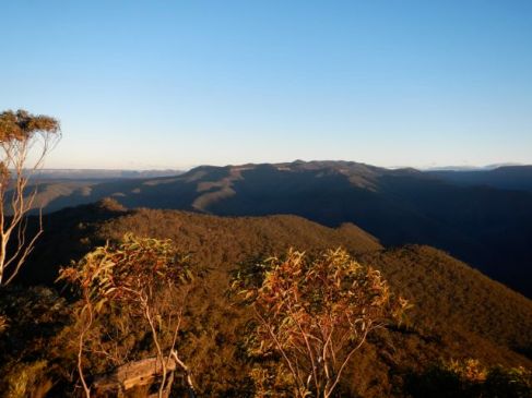
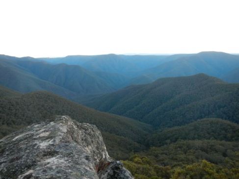
We enjoyed lunch, tea, coffee, and several chocolate bars at the Wombeyan Caves kiosk, and then began the climb out, which was extremely gentle in comparison to what we’d become accustomed to. The view from the top was stunning – steep slopes of thick trees, with a thin dirt road winding down the side.

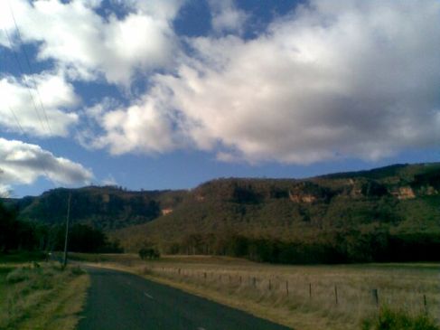
So it was back down, this time descending to the Wollondilly River. This was probably my favourite section of the trip – seemingly endless downhill, swinging around on a dirt road that dropped off in a very threatening way. We felt like we were on some European mountain pass.

If you squint you can almost see Ollie riding past the base of this landslide.

We reached the Wollondilly eventually, and crossed it to start up the hill. Which was, again, exceedingly pleasant and gentle.

We were even treated to some bush humour.

At the top of the hill, we were greeted by Ollie’s mum, come to collect Henry and whisk him away to some other family engagement.

All in all, we had an excellent adventure. However we thought that, if you had 3 days, it would be more fun to do this as a 3-day trip, either camping, or staying at the Jenolan Cabins and then Wombeyan Cabins. That way you’d be able to explore the caves, and not thrash yourself. But then again, we kind of enjoyed trashing ourselves.

Hunter Valley Cycle-Tasting Part Two

Guest Blogger: Maria White

DSCN2245

Welcome back.

100428

For those playing at home (both of you) we made it to the B&B and it was fancy. I ran around the cottage a few times making involuntary noises, alerting the owner to our arrival. Chris apologised for me.

There was a bedroom with an ensuite, a bedroom upstairs with a view, a fireplace, a BBQ, and wait for it _____________ A JACUZZI. I used it twice over the two days that we were there and accidentally dreadlocked my hair in the jets three times. (Some people just don’t learn.) If you want to recreate the experience and get your hair stuck in the spa jets, here is the link to the accommodation.

The second day we rode down down down the mountain to Cessnock, all the while getting severely ‘jangled’. Cessnock was a bit of a culture shock after all the Hunter-Valley-quaintness. It was the kind of town that (despite having very few shops) had FOUR op shops, and get this…. we didn’t even want to buy anything from any of them. Yes, I think Cessnock has seen better times. We got supplies from ALDI and scooted back towards the mountain.
We fell in love with a puppy and a puppy fell in love with my armpit. Her mother barked from the sidelines, disapproving. It was a Montague / Capulet situation and bound to end in tears.

DSCN2272

We visited three wineries that day: Mount View Estate, Peterson’s and Tallavera Grove. Here is the view from Peterson’s. Too serene, too pretty. Something was up.IMG_20130725_153014WE GOT A BIT DRUNK. Chris and I performed a rendition of Snappy Birthday for my brother in Canada via Snapchat.

DSCN2274

Chris told me to hide my helmet so that it wasn't in the shot.

Chris told me to hide my helmet so that it wasn’t in the shot.

Over the two days of wine tasting we bought 8 bottles of wine (carried in panniers) and had a case of Cabernet Merlot from Tallavera Grove (our pick of the wineries sampled) posted back to Sydney.

The third and final day of the trip involved absolutely no wineries to break up the day. I was nervous. We rode through country towns that had one general store, one tiny 1950s church and nout much else but potholes. If we hadn’t been carrying so many bottles of fermented grape juice I would have bought a $2 bag of mandareens from the side of the road. Chris and I had watched Raising Arizona the night before so I was speaking in what I thought was an Arizona accent most of the day.DSCN2285

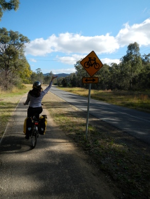
As the day got hotter we approached the Watagans National Park via a State Forest. The road was a steep and unsealed, which meant that we shed a bunch of clothes and often stopped to push the bike up the hill. It was dusty business. As we were pushing our bikes up a part of the hill one Australian Man thought he was the funniest guy on the mountain and said, “You’re meant to actually ride them you know!” He laughed at his joke and Chris responded jovially. Nope. Not having it. This was fucking difficult so I just death-stared the Australian Man until he drove off.

Ten minutes later I thought of a comeback. “THEN WHY ARE THEY CALLED PUSHBIKES?” I yelled to nobody in particular.

DSCN2286

Riding across the ridge was incredibly pleasant and the views were pretty stunning. This picture was taken from a lookout called Bald Monkey Face Head Something [Ed: Monkey Face lookout]:1374943661839

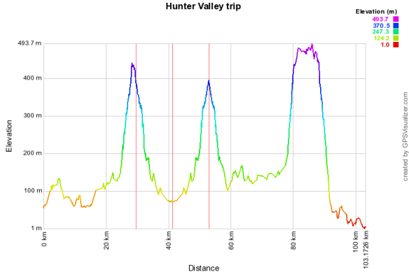
Here is a diagram of our whole trip courtesy of Chris Moore; statistician, magician and owner of this blog. You can use this visual aid to predict the janglyness of our final descent down to Dora Creek station. My brain was throughly rattled.

1374925857-26200

Hunter Valley Cycle-Tasting Part One

 Guest Blogger: Maria White

Image

Bicycle Touring is one of those things that I felt I had done before, until I really thought about it. Kinda like how I assumed I’d met my friend’s 3-year-old until I realised that I had just seen excellent pictures and heard excellent stories about him.

We decided to go to the Hunter Valley. I am not ashamed to say that Chris Moore did all the planning and I was gearing up for camping and not showering, but little did I know that this holiday was going to be fancy.

I did some terrible late-night packing and we got the earliest possible fucker of a train: 5.11am from Central. 

At Woy Woy we changed trains, at Hamilton we changed trains again. It was at Hamilton Station that we met a man who would talk at us for at least 45 minutes. He looked like this:

Screen shot 2013-07-31 at 10.08.25 AM

The Australian Man was the most relentless talker I have ever met. I liked him. However it didn’t take long for me to turn around and pretend he wasn’t there. Chris politely continued to listen, twisting his neck to give the Australian Man eye contact. After 30 minutes or so I began live-tweeting his #oldwhitemanologue

We arrived at Greta (pronounced Greeter) station at about 9am. Ready for work.

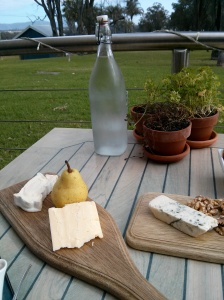
Then we did some cycling. Bought some olives, cycled a bit more, enjoyed a brunch of cheese (like I said, fancy.) The chef recognised my bike and it turned
out that she had also bought a bike from Omafiets. This was a strange coincidence because we were very far from Marrickville (pronounced Merrickveel) at this point. Chris gave her a pump connection thingy [Ed: Woods to Schrader valve adaptor] and we got our tea for freeeeeee! Sexy.
IMG_20130724_104331
IMG_20130724_104328

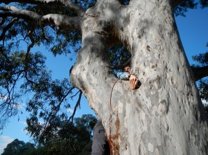
We cycled past many wineries but it still felt a little early to be drinking. Chris tried to climb a tree and it was funny. A butcher bird watched and was confused.

DSCN2249 DSCN2251

We cycled past the Worlds Largest Lolly Kangaroo and it appeared that a tremendous person was visiting it. Here is the evidence (not pictured- Worlds Largest Lolly Kangaroo) :

YES HE CAN

Because it’s ‘a Ford’

We are decent upstanding citizens and therefore we tasted our first wines just after midday. We tried some wines at Brokenwood Winery and The Small Winemakers centre. The lady behind the counter at Brokenwood asked us what we drank at home. “Reds,” I responded. Her face had a knowing look, it wasn’t going to get any more specific than that. At first we were pretty silent during the wine tastings but eventually we learned to muddle through a few adjectives, and even some nouns when describing wines. The more Chris drank the chattier he became. We developed opinions. I decided to dislike Chardonnays, while Chris told people that he was ‘not a fan’ of Shiraz. You know, just generally.

The first afternoon was spent slogging it up a beautiful hill. Our accommodation was at the very top of it- ‘Mount View’. I had to stop frequently because my belly was full of wine and lunch and the roads are unsealed and look, I don’t need to explain myself. Chris decided to take all 4 panniers at this point. I was embarrassed and protested but eventually agreed that it was for the best.DSCN2257

We saw buffaloes I think.

IMG_20130724_155817

This was where it got a bit nuts. It turned out that we had a few kilometres to go to get to the B&B and it was through a section of the Great North Walk i.e. a bushwalking track and pockets of someone’s property. The following images contain paths not to be deemed cycle-worthy by anyone. [Ed: Google Maps had it marked as a cycling route. I have suggested an edit.]

IMG_20130724_162024 DSCN2260

Cycling through the big paddock was probably my favourite part. The cows were behaving strangely. I confused their adorable curiosity with territorial aggression, because I is dumb city folk. As you can see we then CLIMBED OVER BARBED WIRE WITH TWO BIKES AND FOUR PANNIERS. Like you’re supposed to when you go cycling in the Hunter Valley. It felt pretty hardcore.

Did we make it to the luxurious B&B? Did we appropriate the word ‘jangled’ to describe the feeling of being shaken wildly when riding down an extremely gravelly hill? Find out in the next installment of Hunter Valley Cycle-Tasting.

Splendour Rock

Aside

I’d been meaning to do an overnight walk to Splendour Rock for a few months, and the opportunity presented itself on the Monday and Tuesday just passed. Three others were meant to be walking with me, but pulled out the night before. I considered putting it off, but decided to go anyway, with the provision that I brought a PLB. A debt is owed to these track notes of a similar walk.

The parents have lent me their dehydrator, so I tested it on these carrots and zucchini. Took a while, but worked pretty well.

Image

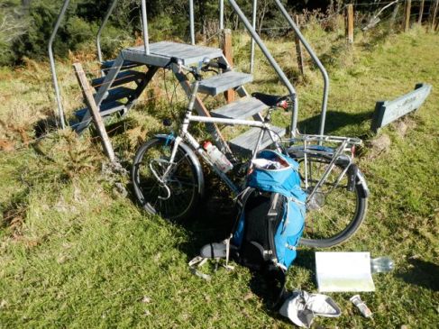
The plan had been to drive to Carlon’s Farm (Dunphy’s Campsite, Green Gully) at the end of the Megalong Valley Road, and then start the bushwalk quite early on Monday morning. However, being on my own (and without a car), I decided to ride my bike in. I had vague memories of it being quite steep… which it was. Fortunately, it was more downhill than up on the way there. The ride was 20km long, and you can see it here on Bikely. It took me 90 minutes to ride from Blackheath Station to Dunphy’s. I locked my bike to the stile and sat down with the map.

Image

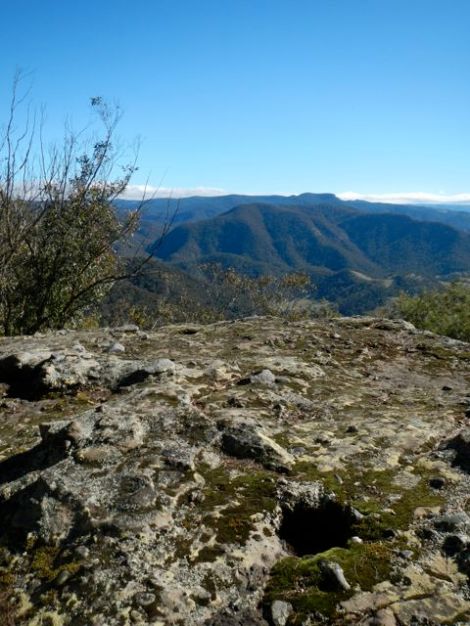
I wasn’t exactly sure which route to take to Splendour Rock. I considered 3 or 4 – the fire trail to Medlow Gap, down to Breakfast Creek and then up to Black Horse Ridge, or Blue Dog Spur. It was 10.30am, and I wasn’t sure if I’d have enough time for the longer routes. In the end I thought, bugger it, I’ll just walk faster – so I headed west up Ironpot Mountain. Here’s a photo looking north, with ‘pots’ visible in the rock.

Image

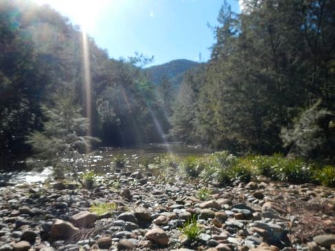
From there it was a very steep shuffle (600m descent in about 2.5km) down Ironmongers Spur to the intersection of Breakfast Creek and the Coxs River, which I reached at midday. Here’s a photo looking north up the Coxs River.

Image

I was getting a bit peckish, but decided to delay lunch until I’d made it to Knights Deck. I wasn’t sure that I’d be able to manage the climb up Blue Dog Spur on a full stomach.

The climb up was brutal. I think I took it a bit too quickly, probably because I was hungry. There was some nice ridge walking up the top though.

Image

The view from Knights Deck was amazing – 180 degrees of stunning views. The three photos below are, left to right, roughly west-north-east, with the middle photo showing the route I’d taken down Ironmonger’s Hill and Spur in the front. To the east, Narrow Neck.

ImageImageImage

Here are some indulgent photos of mushrooms, and a strange shed pupal case or something or that sort. These were taken walking along Blue Dog Ridge, towards the track that runs roughly north-south on the west side of Mount Warrigal, and then south along that track to Mobb’s Soak/Swamp.

Image

Image

Image

I filled up the water bottles at Mobb’s Soak, and took the faint track up to the Warrigal Gap, and then onto Mount Merrimerrigal. It was strange to be surrounded by such low vegetation after being surrounded by forest all day.

Image

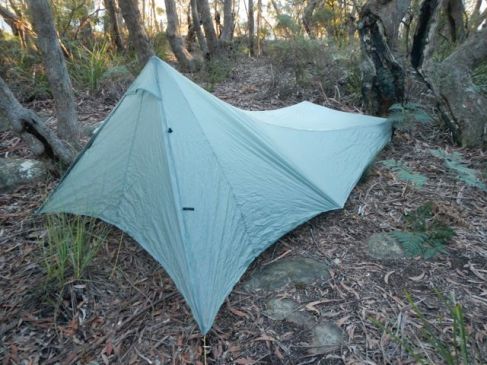
I crossed Dingo Gap to Mount Dingo, and hurried along, worried that I wouldn’t make the sunset at Splendour Rock. I made good time though, and decided to set up the tent before settling in at the end of Splendour Rock. There were a few nice campsites along the track. This was the first outing of my new (second-hand) Tarptent Contrail, which I was pretty happy with. It’s a nice width, you can just sit up in the end of it, and it’s only 950g. Comfortable enough for me.

Image

I clambered down these chains looking for a better photo spot, but realised they were meant for people coming down off the end of Mt Dingo and continuing a walk to the south. So I climbed back up!

Image

The views from Splendour Rock…

Image

Image

Image

At this point my camera ran out of battery. I was just glad it had lasted as long as it did really. The next few are phone-camera photos.

I was too tired to cook the rice I’d brought, so I mixed the rehydrated vegetables in with 2-minute noodles, added a bit of curry spices, and feasted. I resolved to bring more dessert next time. The night was pretty cold (it got down to around 3 degrees and the wind was up a bit), but I was comfortably warm, especially with the new down hood I’m pairing with my down quilt.

The next day, I took the quick way (being a bit worried about how long it would take to ride out), descending west off Mt Dingo to meet up with the main north-south track, then north to Mobbs Swamp, and north along Black Horse Ridge, down to Breakfast Creek, and up Carlons Creek to the bike. Lunch, and then back on the road.

Image

“Honorary member”

I have no idea what this road marking means, but I took it as a form of encouragement.

Image

On the flat bit, looking back up to Medlow Bath – you can just see the Hydro Majestic, left-of-centre on top of the cliffs.

Image

The climb up was not as bad as I’d anticipated. Sure, I was going slowly, in first gear, but in the end it only took me 30 minutes longer than the way in. I also appreciated the rainforest around the road (and the shade it provided!) a lot more on the way up; I’d hardly noticed, flying downhill on the way in.

Out of interest, here were the times I recorded for the various sections (walking pretty quickly, and not really stopping for breaks, except lunch at Knights Deck and Dunphy’s campsite):

Day 1
8.50am Blackheath Station
10.30am Dunphy’s campsite
12.00pm Int. Breakfast Creek and Coxs River
1.15pm-1.45pm Knights Deck
3.15pm Mobbs Soak
4.30pm Splendour Rock

Day 2
8.45am Splendour Rock
9.45am Mobbs Soak
10.40am End of Black Horse Ridge
11.00am Breakfast Creek
11.45am-12.45pm Dunphy’s campsite
2.45pm Blackheath station

Review: City of Sydney cycling confidence course

In the recent months, my mum has increasingly been using her bicycle for transport. She used to ride her bike everywhere “BC” (before children) but for many years did not ride in traffic (though she rides around the local park several mornings a week). She needed a bit of a confidence boost, so we enrolled in the City of Sydney’s free cycling confidence course (run by BikeWise).

As a keen cyclist of many years, I wasn’t sure how much I’d get out of it. Would they be able to teach at a level that both of us would find useful?

Our teachers were a couple of lovely chaps, Dion and Adrian, who met us at the CARES facility at Sydney Park. The rainy conditions meant that everyone else had dropped out – we were the only two students. Many cups of tea and biscuits were consumed before we stepped outside.

The course began with some theory about road rules, right of way, and lane positioning (they introduced three positions: door lane, secondary and primary – more on this later). We were introduced to the four principles of effective cycling (as I remember them anyway!):

  1. See and be seen
  2. Communicate
  3. Ride predictably
  4. Be gracious

Now I like to think I’m a pretty enlightened cyclist, but going through scenarios on the blackboard, and applying these principles, I realised there were a number of ways I could improve my riding. Some great tips I hadn’t thought of:

  • If you’re continuing straight through an intersection, keep pedalling and don’t move to the left – otherwise, cars will think you’re turning left.
  • When a car comes up behind you, turn around and make eye contact. This lets the driver know that you’re aware of their presence, and that they are now part of your decision-making.

Once the theory was over, we collected our bikes and ran through some drills on the basketball court: indicating, looking over our shoulders, and emergency stops. I actually needed to practice my stopping, as my tendency is to come out of the saddle before the bike has completely stopped. Anyway, so far so good, I was getting a lot out of it and so was mum.

The next stage of the course involved a ride to Central Station. Given the rain, this normally would have been cancelled, but we’d both brought wet weather gear and didn’t mind pushing on. If I’d been choosing the route, I probably would have gone straight down Mitchell Rd, up Henderson, and the into the back streets of Redfern. However, our teachers had a much better route planned, which brought home the message that route planning is half the skill. If you know the right back streets your journey can become not only more pleasant, but faster and safer as well.

We took Belmont St, just one street back from Mitchell, and then Buckland, Cope and Phillip. That took us to a back street route I’m familiar with (George, into Prince Alfred Park and then down to Central at Chalmers St). This is a great route – but it was so poorly signposted! I would have been lost several times had I not been following Dion and Adrian, and I live in Redfern, one suburb away. The City of Sydney’s free map is an excellent resource but it’s painful to consult the map at every cross street. A good bike network has to make signage a priority.

We finished the course with a few drills around Central and Redfern. We’d earlier been introduced to the idea of three lane positions: door lane (where you ride really slowly), secondary position (for wider roads, where you’re out of the reach of the door but a car can still pass) and primary position (in the middle of the lane). I found that thinking in these terms made choosing my position a lot easier, as we practiced left- and right-hand turns in moderate traffic.

I find that the last principle – “be gracious” – is always the most difficult in practice (though we didn’t encounter anything of this sort on the course). When someone driving a car comes up behind me and starts beeping their horn, I really just want to start yelling at them. This doesn’t happen to me that often (though my housemates, all women, get it a LOT worse than I do), but I’m still wary of it happening when I ride. Dion gave an honest perspective – when you can’t go as fast as the car behind you, you do feel pressure. There are a number of choices you have: if there’s room, let the car pass. If not, ride a bit faster. Always make eye contact. My initial reaction was indignation; if I’m in the right, why should I move or speed up? I mean, if it was my choice, the speed limit would be 30km/h everywhere except for the highways. Imagine the paradise we’d live in! Perhaps Dion has a point though. We are a long way from my utopian pedestrian/cyclist paradise, and concessions made are not necessarily a defeat. We can be gracious towards drivers, and not concede the point that cycling is just plain better. (As an aside, if people beep their horns or yell at me, my reaction now is to catch up to them at the next red light and attempt to have a polite conversation about safe cycling. I know I should just ignore them, but…)

Even for experienced cyclists, this course had much to offer, so I’d recommend it. Thanks to Dion, Adrian and the City of Sydney.

Cycling down Narrow Neck

Narrow Neck Plateau, just south of Katoomba, runs down between the Jamison and Megalong valleys. Since the 60s there has been a fire trail, Glenraphael Drive, the whole way out (though there’s a locked gate a quarter of the way along), and you can ride your bike all the way to the end. I was unsure of how my rigid forks and slick tyres would cope, but I figured if sections were too tricky I could just get off and walk (which I did).

Part of the reason for this trip was my wondering whether this might be a good way to reach the end of Narrow Neck in a hurry – Clear Hill, at the end of the trail, is the starting point for a lot of interesting bushwalks down into the Megalong Valley and beyond, including one out to Splendour Rock which I’ve been meaning to do for ages. The fire trail along Narrow Neck is normally regarded as an uninteresting road bash. That few extra metres of clearing really does trash the aesthetics, compared to a bushwalking track.

There are stunning views along the way from both sides, though the track tends to follow the east side. I left my bike and headed out to Castle Head. This photo is looking back at the first narrow bit of Narrow Neck.

Here is a view to the west, looking at Megalong Head.

There were some fine looking sundews (Drosera spatulata), a carnivorous native plant.

From Castle Head, there are uninterrupted views to the Ruined Castle and then Mount Solitary (you can see the path where we climbed up a few weeks ago). Lake Burragorang is in the distance.

Just as I was leaving Castle Head, the rain and fog moved in. I’d been having a bit of trouble getting traction up the hills on the slick tyres, and the rain made matters worse. The lack of suspension made riding down hills a bit of a chore – hard on the knees and the wrists. It can be done but it’s not ideal.

I found a nice little overhang to have lunch in, where the plateau narrows again (the “second neck”), and waited for the rain to move on.

But the rain stayed. With the prospect of further views diminished, I decided to head back.

It took me about an hour and ten minutes to ride from Katoomba Station to the overhang, a distance of about 10km. I stopped around 7km from the Clear Hill, so perhaps another 45 minutes? I’ll definitely consider this as an option for future bushwalking trips, but probably only if I can borrow a mountain bike.

Mushroom epilogue

After the underwhelming Newnes episode, I was still craving mushrooms. The universe must have been listening because yesterday I was at uni and ran into my friend Joe, who told me he’d left a box of saffron milk caps in the fridge for me. Thanks Joe!

I strapped them to my bike and set off home, and was cruising along when Else called. She was just around the corner and had found a box each of mushrooms and tomatoes, that she thought had fallen off the back of a providore’s truck. She was on her way to Katoomba and couldn’t carry much, so I helped her out and took the rest home.

This is why you must always carry a rope!

Mushroom box 1, mushroom box 2, tomato box

Slim pickings in Newnes

Ollie, Tony and I had decided to go mushrooming. Tony proposed a route from Bell to Lithgow, via the Newnes State Forest. Sounded jolly good. We set off on the train, Tony and I wish our practical Surly Long Haul Truckers, and Ollie with his ridiculous Surly 1×1 (because it only has one gear).

As usual Tony and Ollie set a cracking pace and I was soon wheezing up the hills behind them. The single speed helped slow Ollie down a bit. We turned off the paved road at the Zig Zag sign and cruised through the dirt.

We reached the edge of the pine plantations, and eagerly bounded into them, expecting to be greeting by a bounty of mushrooms (as experienced on previous trips to similar pine forests). However, we had a hard time finding any mushrooms at all, let alone edible ones. Various factors may have contributed to this paucity of fungus: time of year, location, temperature, rainfall, voodoo magic. All I know is, there were hardly any.

We sat down for lunch and I was delighted to find this little blighter sucking a hole into my leg. I’d forgotten to take any leech photos on my recent Mt Solitary trip, so I attempted to do so now. However the macro function of this camera is not very good, and this photo gives a better view of some campfire strewn with rubbish. Bloody rednecks.

There were a lot of wombat burrows. Perhaps they had eaten our mushrooms?

Eventually we found a saffron milk cap, and a few slippery jacks. Here Tony is seen with a slippery jack.

After an hour or so of bush bashing and foraging, we had a meagre harvest, and decided to ride into Lithgow and check out their bakeries.

On the road to Lithgow we encountered some stone pagodas that I thought indicated we were near the Gardens of Stone National Park (actually it’s much further north of Lithgow).

Thereafter we descended a long and bumpy dirt road, which was a bit of fun but also bone jarring. Despite Tony’s careful wrapping, the mushrooms got beaten around a bit. Here is some exciting descending:

We sampled the local bakeries in Lithgow (rating: average), and generally wandered around. We found a possible source for our bad luck: someone in Lithgow has been using Black Magic. We shook our heads sternly and muttered, “No good will come of this.”

Aww, sleeping babies.

The damage to the mushrooms turned out to be mostly cosmetic, and they were duly fried and eaten. Not a bad meal at all.